Communities Start Risk Mapping Training
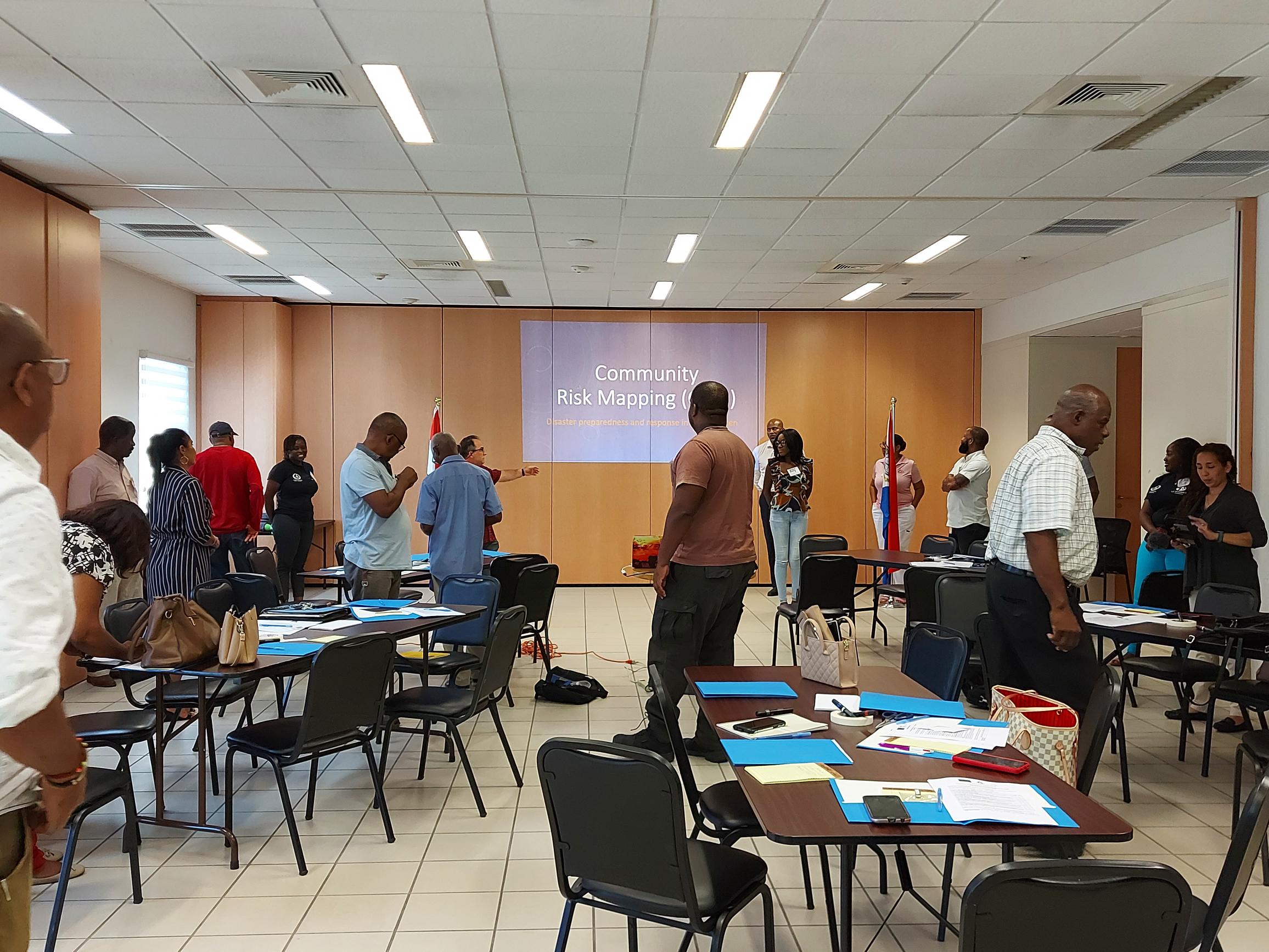
Representatives from 8 communities of Sint Maarten started a Risk Mapping Training as a part of the EU-funded project “Technical Assistance for Disaster Response and Preparedness.
This project started in June 2022, and its overall objective is to support the Government of Sint Maarten in its vision to strengthen its institutional capacity to plan, monitor and coordinate post-disaster response and reconstruction.
The Risk Map Training aims to equip community leaders, community-minded people and other key stakeholders with the necessary understanding and know-how about Community Risk Mapping (CRM) to be able to facilitate it in their own communities.
The community preparedness expert and facilitator of this training, Ignacio Cristóbal, commented that “The essence of this training is to organize communities, so they can be ready, well-prepared, and self-managed in case of emergency or disaster situations. This way, they can respond much better, saving their lives and protect their livelihoods”.
In total, 32 participants are attending this training, and they are representatives from 8 districts:
St Peters, Middle Region, South Reward, Cole Bay, Simpson Bay, Philipsburg, Sucker Garden and Hope State.
About the methodology
“The training offers a participatory methodology where community members are the protagonists of the process and assume the leadership and commitment of their own preparedness and response, with a multicultural and inclusive approach”, said the facilitator, Ignacio Cristóbal.
At the end of the training the participants will understand the basic Disaster Risk Reduction (DRR) concepts and main steps of the CRM process, and be familiarized with the most relevant tools to collect information, identify, analyze and prioritize hazards and planning community DRR actions.
Following the training, the participants will be supported to implement the community mapping in all the districts. This will take place from October to December, commencing Friday, October 21. Participants in the training can be identified by their T-shirts stating community risk mapping
Also, a communication session is included in the training in order to understand community perspectives on previous and current communication campaigns, messages about preparedness, emergency response and disaster risk reduction, and any other relevant issues related to communications.
The communication expert and facilitator, Claudia Zaldaña, commented that “Communication is a key element when an emergency event or disaster occurs, but the best way to have the information flowing is working together on it and thinking about all the audiences”.
The project also included a training in Geographic Information System (GIS) that will help to plan and respond better in emergency situations. The GIS training took place from 21 to 23 September, 2022.


